Tocht Stappen La Chapelle-Hareng - Chemin de la Fontaine au Dragon  -  La Chapelle-Hareng - Photo

Chemin de la Fontaine au Dragon - La Chapelle-Hareng

 tracegps
tracegps

Gebruiker

© OpenStreetMap contributors
Lengte
Lengte
15,8 km
Max. hoogte
Max. hoogte
202 m
Positief hoogteverschil
112 m
Km-Effort
Km-Effort  
17,3 km
Min. hoogte
Min. hoogte
169 m
Negatief hoogteverschil
114 m
Boucle
Boucle
Ja
Datum van aanmaak :
2014-12-10 00:00:00.0
Laatste wijziging :
2014-12-10 00:00:00.0

(0 Bericht)

Stappen
Stappen
4h00
Moeilijkheid : Moeilijk

Scan deze QR-code om de tocht te openen in de SityTrail-applicatie

Gratisgps-wandelapplicatie

Logo SityTrail SityTrail

IGN / Geografische instituten

SityTrail uit de App Store downloaden SityTrail uit Google Play downloaden

Logo SityTrail SityTrail World

De wereld gaat voor u open

SityTrail uit de App Store downloaden SityTrail uit Google Play downloaden SityTrail op Huawei AppGallery downloaden

Over ons

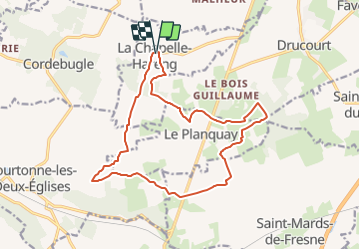
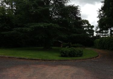
Tocht Stappen van 15,8 km beschikbaar op Normandië, Eure, La Chapelle-Hareng. Deze tocht wordt voorgesteld door tracegps.

Beschrijving

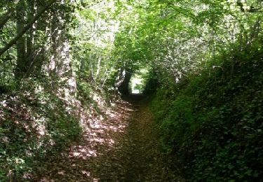
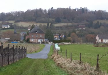
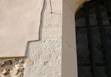
Circuit proposé par la Communauté de Communes du canton de Thiberville . Départ de l’église de La Chapelle-Hareng. A découvrir : l’église avec sa voûte du 16e siècle. Cadran solaire sue l’église, la mairie dans l’ancienne maison de la charité, la source de la rivière le Courtonnel. Ce circuit a été numérisé par les randonneurs du CODEPEM. Merci à Jean-Marie.

Hoogteprofiel

Foto's

Plaatsbepaling

Land:
France
Regio :
Normandië
Departement/Provincie :
Eure
Gemeente :
La Chapelle-Hareng
Locatie:
Unknown
Vertrek:(Dec)
Vertrek:(UTM)
311317 ; 5443348 (31U) N.

Wandeltochten in de omgeving

Tocht Stappen Barville - Barville - Photo
Stappen
werth

Stappen

Gemakkelijk
(1)
Barville, Normandië, Eure, France
7,8 km | 8,7 km-effort
2h 5min
Neen
Tocht Stappen Courtonne-les-Deux-Églises - Courtonne les deux Eglises - Photo
Stappen
Eve - Line

Stappen

Medium
Courtonne-les-Deux-Églises, Normandië, Calvados, France
12,9 km | 15,6 km-effort
2h 43min
Ja
Tocht Andere activiteiten La Chapelle-Hareng - La chapelle Hareng - Photo
Andere activiteiten
werth

Andere activiteiten

Heel gemakkelijk
(1)
La Chapelle-Hareng, Normandië, Eure, France
6,1 km | 7,1 km-effort
1h 40min
Neen
Tocht Stappen Valorbiquet - St Julien de mailloc - Photo
Stappen
werth

Stappen

Medium
Valorbiquet, Normandië, Calvados, France
7,9 km | 10,2 km-effort
2h 23min
Ja
Tocht Stappen Barville - Barville- 27 - Photo
Stappen
Sylber

Stappen

Gemakkelijk
Barville, Normandië, Eure, France
8,8 km | 10 km-effort
2h 40min
Ja
Tocht Stappen La Chapelle-Hareng - chemin de la Baronniere - Photo
Stappen
ymarvin

Stappen

Gemakkelijk
La Chapelle-Hareng, Normandië, Eure, France
6,6 km | 7,7 km-effort
1h 31min
Ja
Tocht Stappen La Chapelle-Hareng - Chemin de la Baronnière  -  La Chapelle-Hareng - Photo
Stappen
tracegps

Stappen

Gemakkelijk
La Chapelle-Hareng, Normandië, Eure, France
6,3 km | 7,3 km-effort
1h 34min
Ja
Tocht Stappen Thiberville - Chemin des Housiaux  -  Thiberville - Photo
Stappen
tracegps

Stappen

Medium
Thiberville, Normandië, Eure, France
12,6 km | 13,4 km-effort
3h 10min
Ja
Tocht Stappen Barville - Chemin de la Fontaine  - Barville - Photo
Stappen
tracegps

Stappen

Medium
(1)
Barville, Normandië, Eure, France
8 km | 9 km-effort
2h 0min
Ja


Sluiten
Mijn abonnementen